
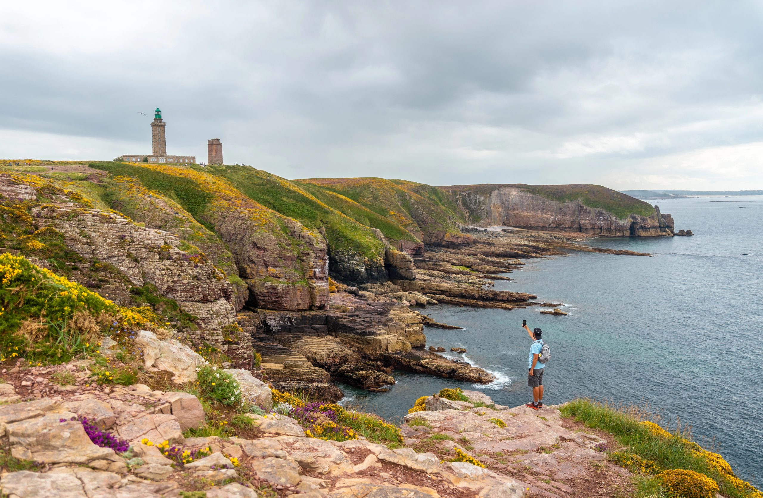
You don’t need to be an experienced mountaineer to experience France’s most breathtaking landscapes.
When people think of hiking in France, they picture the Alps — technical climbs, via ferratas, and trails that require crampons and ice axes.
But France has thousands of accessible trails that deliver jaw-dropping views without requiring advanced skills, specialized gear, or extreme fitness. From coastal paths overlooking turquoise Mediterranean waters to gentle mountain walks with Alpine panoramas, from lavender-scented Provence trails to volcanic landscapes in the Massif Central, France offers beginner-friendly hikes that rival the beauty of any expert route.
Here are the best beginner-friendly hiking trails in France — stunning views guaranteed, mountaineering experience not required.
🏔️ Lac Blanc, Chamonix Valley
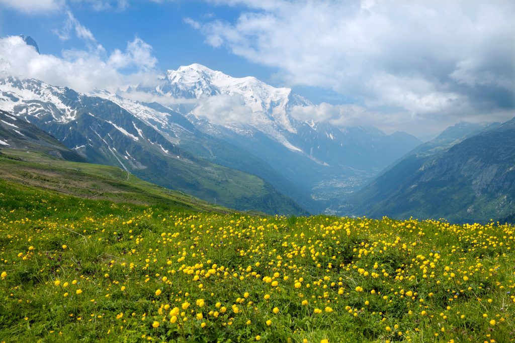
Where: Chamonix, French Alps Distance: 7 km round trip Elevation gain: 270m Time: 2.5–3 hours Difficulty: Easy to moderate
Why Go
This is the easiest way to get Alpine views that look like they belong on a postcard. A cable car does most of the climbing for you, then a gentle trail leads to a crystal-clear mountain lake with the Mont Blanc massif reflected in its waters.
The Hike
Take the Flégère cable car from Les Praz (near Chamonix) to 1,877m. From there, follow the well-marked trail to Lac Blanc at 2,352m. The path is wide, well-maintained, and never technical.
The lake sits in a rocky bowl with 360° views — Mont Blanc, the Aiguilles Rouges, glaciers, and jagged peaks in every direction. On calm days, the reflections in the lake are perfect.
Practical Tips
Best time: June–September (snow-free) Start early: The trail gets crowded by midday Bring layers: It’s significantly cooler at altitude Refuge: Lac Blanc refuge serves food and drinks (cash only) Alternative: Continue to Lac des Chéserys (30 minutes more) for even better views and fewer people
🌊 Sentier du Littoral, Côte d’Azur
Where: French Riviera (multiple sections) Distance: Varies (2–15 km sections) Elevation gain: Minimal Time: 1–5 hours depending on section Difficulty: Easy
Why Go
The Sentier du Littoral (Coastal Path) follows the Mediterranean coastline through some of the French Riviera’s most beautiful scenery — turquoise coves, red rock cliffs, hidden beaches, and views over the sea.
Best Sections
Cap d’Antibes loop (5 km, 1.5 hours) — circles the peninsula with views of millionaire villas, rocky coastline, and the Mediterranean. Mostly flat and paved.
Saint-Raphaël to Agay (12 km, 3–4 hours) — follows the dramatic red Esterel cliffs with stunning coastal views. More rugged but never difficult.
Cap Ferrat (7 km, 2 hours) — loops around one of the Riviera’s most exclusive peninsulas with views of Nice, Monaco, and luxury estates.
Practical Tips
Best time: March–May or September–October (avoid summer heat and crowds) Bring: Sunscreen, hat, water, swimsuit (for beach stops) Parking: Can be challenging in summer — arrive early or use public transport Swimming: Many sections pass secluded coves perfect for a dip
🌋 Puy de Dôme, Auvergne
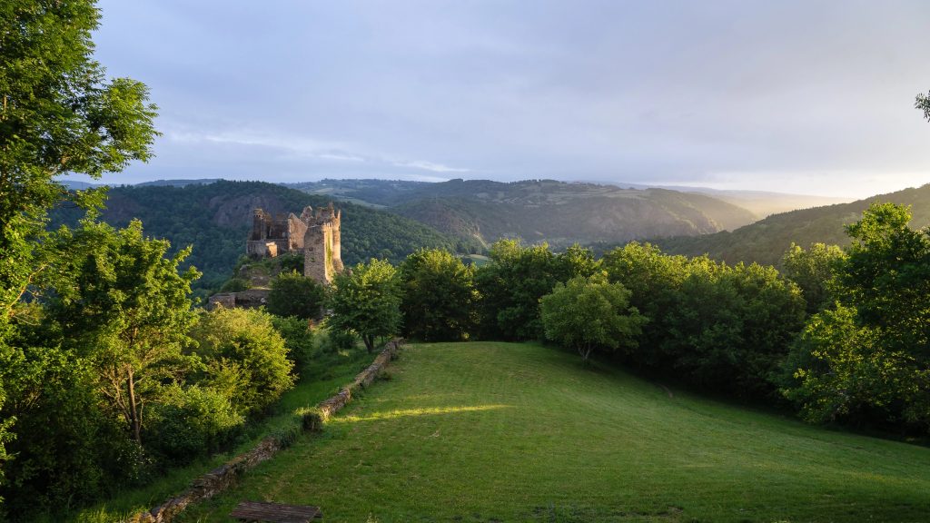
Where: Massif Central, central France Distance: 4 km round trip (or take the train) Elevation gain: 400m Time: 1.5–2 hours up, 1 hour down Difficulty: Moderate (or easy if you take the train)
Why Go
Hike to the summit of an extinct volcano with panoramic views over the volcanic landscape of Auvergne. On clear days, you can see 80+ volcanic peaks stretching to the horizon.
The Hike
You can either hike the Chemin des Muletiers (ancient mule path) or take the panoramic train to the summit at 1,465m.
The hiking trail zigzags up the volcano’s slope through meadows and volcanic rock. It’s steep in sections but never technical. The summit offers 360° views over the Chaîne des Puys volcanic range — dozens of perfectly cone-shaped extinct volcanoes.
At the top, you’ll find a Roman temple ruins, a weather station, and a café.
Practical Tips
Best time: May–October Train option: €16 round trip if you don’t want to hike up Summit weather: Can be windy and cold even in summer — bring a jacket Combine with: Visit Vulcania (volcano theme park) nearby Sunset: The summit is magical at sunset (check last train time if not hiking down)
💜 Sentier des Ocres, Roussillon
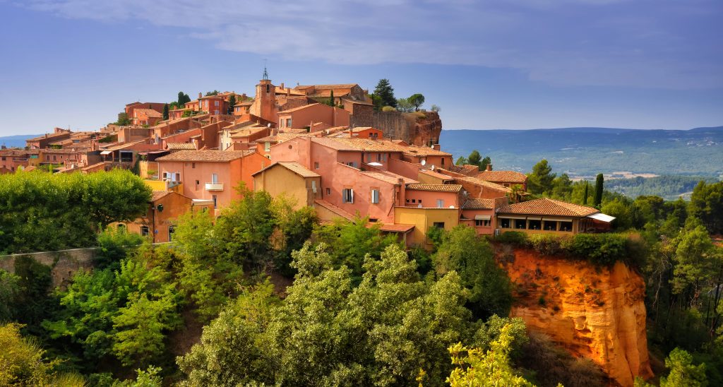
Where: Luberon, Provence Distance: 3.5 km loop Elevation gain: 100m Time: 1–1.5 hours Difficulty: Easy
Why Go
Walk through ochre cliffs in every shade of red, orange, yellow, and pink — a landscape that looks more like Arizona than France. This is one of Provence’s most unique and photogenic hikes.
The Hike
The trail loops through former ochre quarries with towering cliffs, narrow canyons, and pine forests. The contrast between the red-orange ochre and green pines is stunning.
The village of Roussillon itself is built from ochre stone and perches on a cliff edge. Before or after the hike, explore the village’s colorful streets and enjoy views over the Luberon Valley.
Practical Tips
Best time: Spring (wildflowers) or fall (cooler temperatures) Avoid: Midday in summer (no shade, very hot) Entry fee: €3 for the ochre trail Wear old clothes: Ochre dust stains Combine with: Visit nearby villages like Gordes and Bonnieux Photography: Late afternoon light makes the ochre glow
🏔️ Cirque de Gavarnie, Pyrenees
Where: Pyrenees National Park Distance: 8 km round trip Elevation gain: 350m Time: 3–4 hours Difficulty: Easy to moderate
Why Go
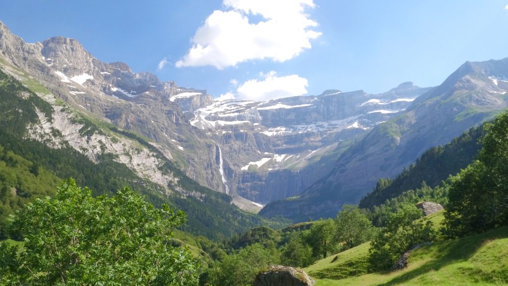
Hike to one of Europe’s most spectacular natural amphitheaters — a 1,500m wall of cliffs with Europe’s highest waterfall (422m) cascading down the center. It’s a UNESCO World Heritage site and one of the Pyrenees’ most iconic landscapes.
The Hike
The trail starts from Gavarnie village and follows a wide, well-maintained path up the valley. The cirque grows more impressive with every step as the cliffs tower higher above you.
The path is never steep or technical — it’s essentially a long, gentle uphill walk. At the end, you stand at the base of the cirque with waterfalls, cliffs, and snow-capped peaks surrounding you.
Practical Tips
Best time: June–September (waterfall is most impressive in spring/early summer) Winter: The waterfall freezes into a spectacular ice column Crowds: Popular but the valley is large enough to absorb people Extend: Experienced hikers can continue to the Brèche de Roland (challenging) Wildlife: Watch for marmots, chamois, and Pyrenean vultures
🌲 Lac de Gaube, Cauterets
Where: Pyrenees National Park Distance: 6 km round trip Elevation gain: 200m Time: 2–3 hours Difficulty: Easy
Why Go
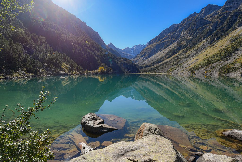
A gentle forest walk leads to a stunning mountain lake with the Vignemale (highest French Pyrenean peak) reflected in its waters. This is one of the Pyrenees’ most accessible and beautiful hikes.
The Hike
Take the Pont d’Espagne chairlift (or walk 30 minutes) to the trailhead. From there, a wide path winds through pine forest alongside a rushing stream to Lac de Gaube.
The lake is a brilliant turquoise-blue surrounded by peaks. A small refuge serves food and drinks. You can walk around the lake or simply sit and enjoy the view.
Practical Tips
Best time: June–September Chairlift: €7 round trip (saves 30 minutes each way) Refuge: Serves meals and snacks (cash preferred) Extend: Continue to Lac des Oulettes (2 hours more, moderate difficulty) Combine with: Visit Cauterets spa town and thermal baths
🏖️ Calanques de Cassis
Where: Near Marseille, Mediterranean coast Distance: 8–12 km depending on route Elevation gain: 200–300m Time: 3–4 hours Difficulty: Moderate
Why Go
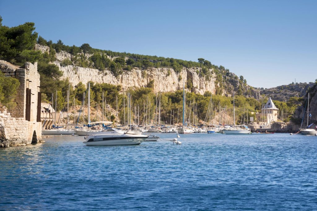
Hike through dramatic limestone cliffs to hidden coves with turquoise water. The Calanques are like Norwegian fjords transplanted to the Mediterranean — steep white cliffs plunging into crystal-clear water.
The Hike
Multiple trails lead from Cassis village to different calanques (coves). The most popular route goes to Calanque d’En-Vau — the most spectacular but also the most challenging.
For easier options, hike to Calanque de Port-Miou (1 hour, easy) or Calanque de Port-Pin (1.5 hours, easy to moderate).
The trails are rocky and exposed with some steep sections, but never technical. The reward is swimming in pristine coves surrounded by dramatic cliffs.
Practical Tips
Best time: April–June or September–October (July–August is too hot and crowded) Summer closures: Trails often close in summer due to fire risk — check ahead Bring: Lots of water, sun protection, swimsuit Start early: Parking fills up by 9 AM in season Boat option: Take a boat tour if trails are closed
🏔️ Aiguille du Midi to Plan de l’Aiguille
Where: Chamonix, French Alps Distance: 9 km Elevation gain: None (all downhill) Time: 2.5–3 hours Difficulty: Moderate
Why Go
Take a cable car to 3,842m (one of the highest cable cars in the world) for mind-blowing Alpine views, then hike down through spectacular mountain scenery. All downhill means it’s easier than it looks.
The Hike
Take the Aiguille du Midi cable car to the summit (€65 round trip). Spend time on the viewing platforms with Mont Blanc, glaciers, and jagged peaks in every direction.
Then take the cable car down to the mid-station (Plan de l’Aiguille, 2,317m) and hike down to Chamonix. The trail descends through alpine meadows with constant views of the Mont Blanc massif.
Practical Tips
Best time: July–September Book cable car ahead: It sells out in summer Altitude: The summit is very high — some people feel effects of altitude Bring layers: It’s freezing at the top even in summer Alternative: Hike down to Montenvers (Mer de Glace) instead
🌿 Gorges du Verdon Rim Trail
Where: Provence, near Moustiers-Sainte-Marie Distance: Various sections, 2–15 km Elevation gain: Minimal Time: 1–5 hours Difficulty: Easy to moderate
Why Go
Walk along the rim of Europe’s deepest canyon — the Gorges du Verdon — with views down to the turquoise river 700m below. The scenery is dramatic and the trails are well-maintained.
The Hike
Multiple trails follow the canyon rim. The Sentier Martel is the most famous (15 km, challenging), but shorter rim walks offer spectacular views without the difficulty.
Try the Belvédère de Mayreste loop (5 km, 2 hours, easy) for stunning viewpoints without technical sections.
Practical Tips
Best time: April–June or September–October Avoid: Summer heat and crowds Combine with: Kayaking or swimming in the gorge Stay in: Moustiers-Sainte-Marie (beautiful hilltop village) Drive: The scenic Route des Crêtes offers pullouts with views
🥾 Essential Hiking Tips for France
What to Bring
Always pack: Water (1–2 liters), snacks, sun protection, layers, rain jacket, first aid kit, phone with offline maps
Footwear: Hiking boots or sturdy trail shoes (not sneakers)
Navigation: Download trails on apps like AllTrails or use IGN maps
Safety
Check weather: Mountain weather changes quickly
Tell someone: Share your plans and expected return time
Start early: Avoid afternoon thunderstorms in mountains
Know your limits: Turn back if conditions worsen or you’re tired
Trail Etiquette
Stay on marked trails: Protect fragile ecosystems
Pack out trash: Leave no trace
Yield to uphill hikers: They have right of way
Respect wildlife: Observe from distance, don’t feed
The Bottom Line
France’s beginner-friendly trails prove you don’t need technical skills or extreme fitness to experience world-class mountain scenery, dramatic coastlines, and unique landscapes.
These hikes deliver stunning views, memorable experiences, and that satisfying feeling of accomplishment — without requiring crampons, ropes, or mountaineering courses.
Whether you want Alpine peaks reflected in mountain lakes, Mediterranean coves with turquoise water, volcanic landscapes, or ochre cliffs, France has accessible trails that will take your breath away.
Ready to lace up your hiking boots? France’s most beautiful landscapes are waiting — and they’re easier to reach than you think.
